Navigate the transition
Act on what matters
ECOshifter is your copilot for climate adaptation and ecological transition, built for territories, organizations, and the experts who guide them.
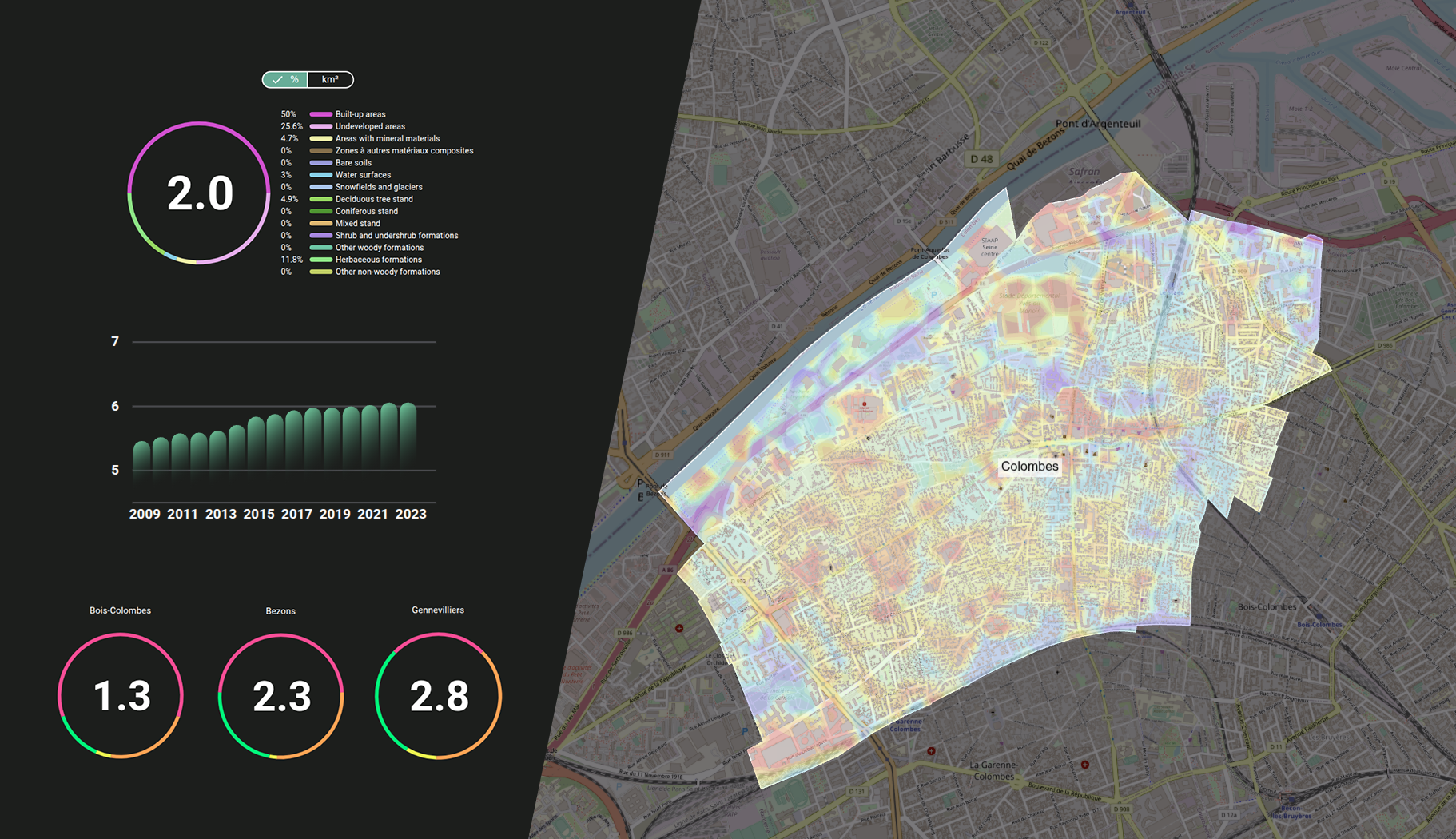
HEAT ISLANDS
THERMAL COMFORT
LAND ARTIFICIALIZATION / SOIL SEALING
LAND USE
SOIL QUALITY
FLOOD RISKS
SURFACE TEMPERATURE
SHADE IMPACT
READY
FOR EUROPE
100%
COVERING OF FRANCE
100%
SOVEREIGN
WHAT ECOSHIFTER DOES
From data to decision & communication,
in one place
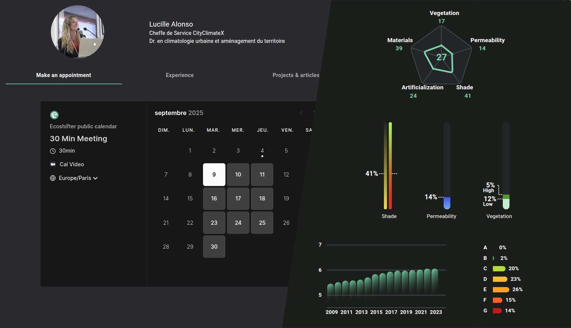
01 — UNDERSTAND
Turn complex climate and ecological data into clear, actionable intelligence on your territory, your assets, your risks.
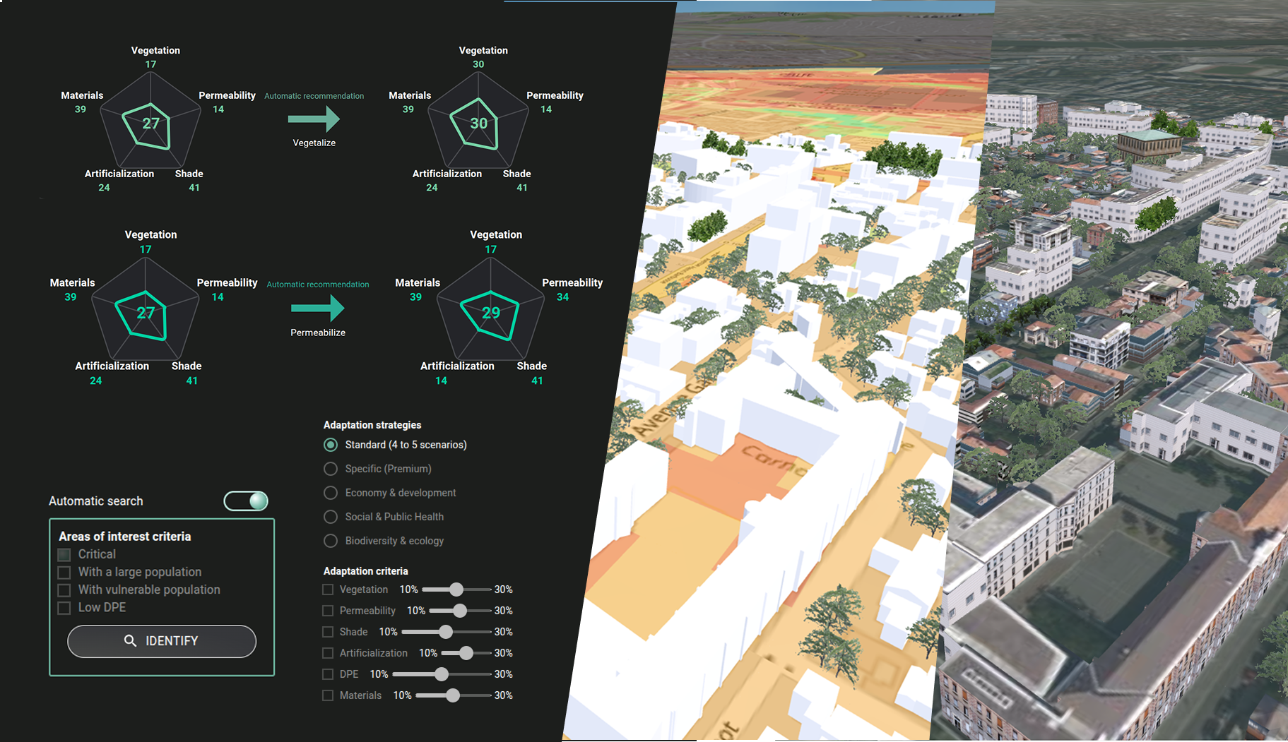
02 — DECIDE
Prioritize. Compare scenarios. Allocate resources where they matter most, with your data and trusted open data, in one place.
03 — ACT
Turn strategy into real-world impact. No friction, no black box. Open methods.
04 — COMMUNICATE
Share maps, dashboards, and insights with elected officials, teams, or the public. Make the transition visible.
THE PLATFORM
A platform built
differently
ECOshifter combines interactive maps, light digital twin, clear dashboards and open data into a sovereign, easy-to-use environment. No black box. No data lock-in. No complexity for complexity’s sake.
Interactive maps
Light Digital Twin
Curated Open Data
Your Data
Clear Dashboards
Simple indicators
Scenarios
Human experts
DIGITAL SOVEREIGNTY
FRUGAL
FOR WHOM
Built for those who act
Territories & Local Authorities
Understand your vulnerabilities. Lead your adaptation plan. Communicate with confidence, whatever the size of your territory.
Companies & Organizations
Map your exposure. Align with regulatory expectations. Turn ecological transition into a genuine competitive edge.
Experts & Consultants
Bring your clients a sharper, faster, more credible analysis. Your expertise, amplified.
WHAT THEY SAY
Real teams, Real feedback
“This is clear, readable, and genuinely engaging. Our territory needs this tool.”
An elected official from a mid-sized city, ready to drive change. France
“We already have strong data infrastructure and powerful dashboards, but your platform solves a real problem we face: making that information simple, understandable and accessible to decision-makers and citizens alike.”
Data team, major city. France
Ready to ECO-shift?
No expertise required. No perfect conditions. No crazy budget.
–
Just the will to act.
Join the ECOshifters.